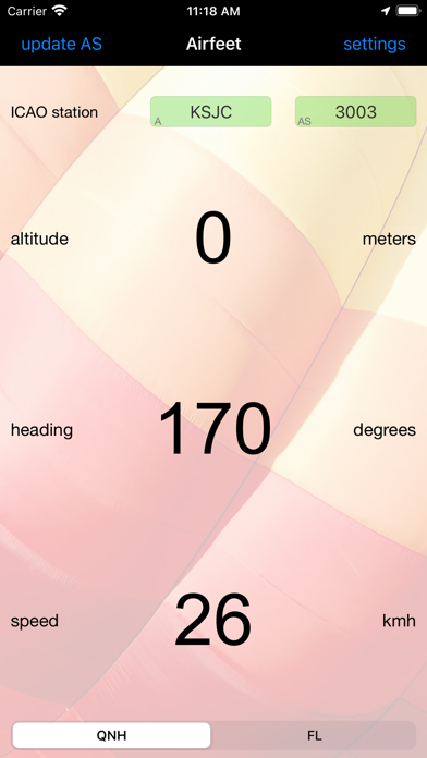
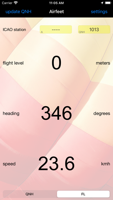
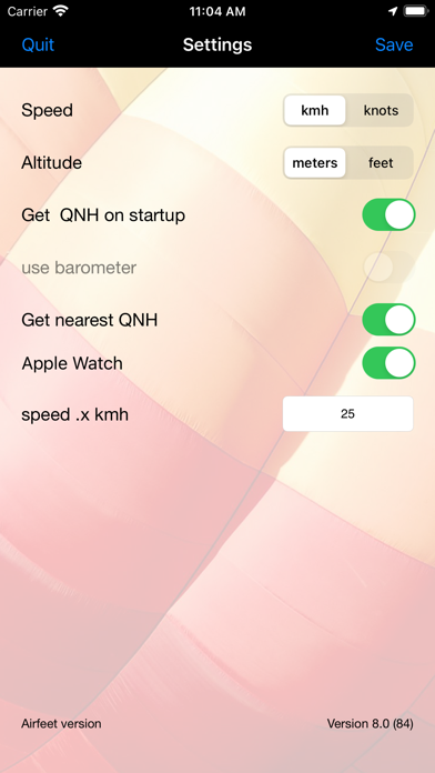
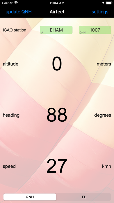
This app is an intelligent flight instrument that reads altitude. It is designed for devices that contain a barometer. This includes iPhone6, iPhone6s, iPhone6 Plus and iPhone6s Plus models running IOS 8.0 or later. For altitude reading it automatically retrieves the QNH or AS Altimeter Setting from the web and uses it in combination with the pressure sensor (barometer) to determine the actual altitude. You can either select an ICAO METAR station, like EHAM or KJFK for Schiphol and JFK airports, or enter the QNH directly in the app. It is ideal for a number of air sports to be used as a backup. Besides altitude and flight level this instrument also displays true heading and speed. The indicated values are displayed using a large font so they can easily be read from a distance. When backgrounded, this app is inactive to save power. Device requirements: - GPS (required) - Barometer (strongly recommended) Altimeter details The altimeter is using the barometric pressure sensor of the iPhone when available. For devices that do not contain a barometer altitude is measured in the conventional way using a GPS. Pilots who fly airplanes, gliders, hotairballoons or other airframes are familiar with altimeter settings. This setting is retrieved by looking up a METAR report for a given area, most often an airport, and locate the QNH or AS value in it. This value is then used to setup the aircraft altimeter. This device automates this process by retrieving it from the web and then automatically use it to setup the airfeet instrument. It is possible to override the automatic retrieved value by entering the QNH or AS value manually. When the field is touched the keyboard will popup and the value that could be manually entered. Same is true for the ICAO station identifier like EBBL or KBOS. Next to the ICAO station field the activity indicator will show up when network access is in progress. This will only happen at app startup or when the manual “update QNH” or “update AS” for USA key is selected. Selecting “flight level mode” by using the “QNH-FL” switch on the bottom of the main screen, 1013.25 millibar or 29.92 inches of mercury reference pressure is used. In this mode the “altitude” label will change to “flight level” and the indicated value will be the level in feet or meters. This mode is only available for devices that contain a barometer and will be disabled on other devices. Heading details The GPS is used to determine the heading. The indicated true heading in displayed in degrees. Magnetic heading is not available. To work reliably an adequate GPS signal is required. Speed details For speed measurements the GPS needs to be operational. The speed can be set to knots or kilometers per hour. For this the “speed .x knots” or “speed .x kmh” settings are available. The set value determines at what speed a digit after the comma is displayed. When this setting is for example, set to 25, the speed below 25 is displayed as 24.2, and 25 and above is displayed without extra digit to make it more readable. Version 3.0 Enhanced manual QNH settings when no network is available to automatically retrieve this. Version 2.0 new feature, automatically locate nearby airport option is now available. The station/airport field contains a small A or M indicator in the left bottom to indicate Automatic or Manual mode. Version 2.1 new feature, the QNH is now automatically updated when the app is started and "Get AS at startup" option is selected. Version 4.4 Update airports for QNH retrieval.